GETTING THERE – Part 2 …….
The Construction & Impact of I-95 in Richmond, RI
By HHA Member Richard G. Prescott with Richard Wolke, President of the Richmond Historical Society
Road Crew brings Wyoming into the 20th century
 This photo is from page 240 of the book “Driftways into the Past”. The book was published in 1976 by the Richmond Historical Society, as part of the town’s celebration of the nation’s bicentennial. The photo was taken in Wyoming c. 1925, as a road crew prepared to pave Rte 3. The Segar Store, now the Wood River Inn, can be seen behind the crowd. The building behind that is the former Richmond Bank. From stagecoach days, the village of Wyoming was a busy center of commerce, manufacture and travel. However, by the 1940’s the automobile had made the intersection of Routes 3 & 138, seen here, obsolete and dangerous. Plans for the alternative were underway even before the end of WWII. In 1952 a bridge was completed that would become the center of that intersection.
The alternative, the Kingston Interchange, would be a modern cloverleaf. The highway that passed over the new intersection would be called Rhode Island Route-95. Today it is Interstate-95 and the “Kingston Interchange” is Exit #3.
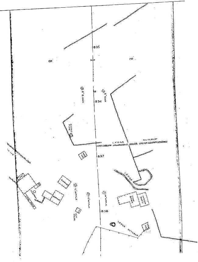
Map From Driftways into the Past Drawn in 1976
 The building of the bridge for the “Kingston Interchange” and the subsequent construction of RI-95 brought great changes. In Wyoming, the area most affected was between Canob Pond and Stilson Rd. This map, also from “Driftways”, provides the locations of buildings that were still standing in 1976. It also shows sites of buildings and features lost to time and progress. The next series of pictures focuses on the changes brought about by this construction. You may be able to use this map to locate the buildings and sites featured in those pictures.
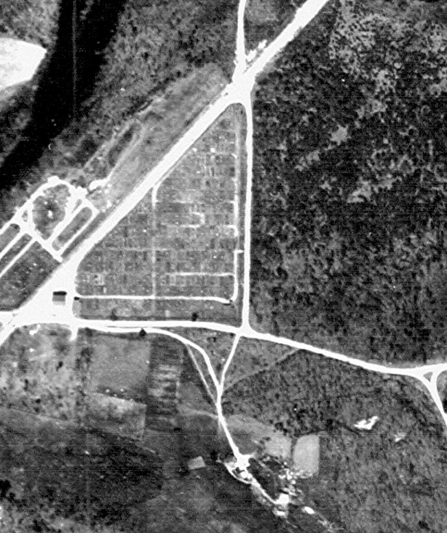
Aerial View of the Future Site of I-95’s Exit #3
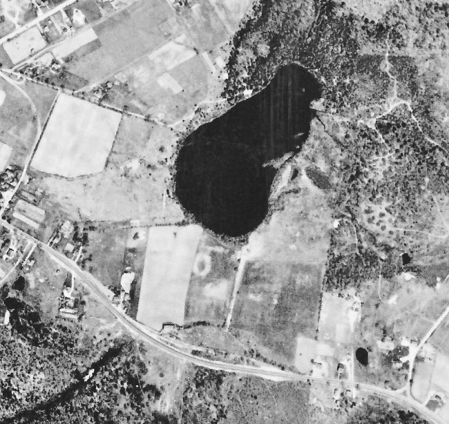 Canob Pond is in the center of this 1939 aerial photo. The fields around much of the lower half of the pond belong to the Reynolds L. Card Farm. The road below the pond is Rte. 138, passing from Wyoming to the left, toward Kingston to the right. The bridge that will become the Exit #3 overpass will be built here. It was the first major construction to take place along the route of the highway that revolutionized travel in Rhode Island.
Notice
- The curve made by Rte. 138 below Canob Pond. It takes advantage of high ground, while avoiding a bolder field that is low and wet.
- One of the Card Farm’s fields is the large light colored rectangle that touches the pond with at its upper right corner. Their dairy barn is on the lower edge of the same field.
- The Card farmhouse is on Rte. 138, just to the left of that same field. It will be moved back on that field a hundred feet or more to escape the relocation of 138.
- The Card family lost over 30 acres to the construction RI Rte. – 95, more than any property owner in Richmond or in Hopkinton. The completed “Kingston Interchange” encompassed nearly their whole farm!
Looking Northeast From Rte. 138
 This photo looks northeast from Rte. 138’s high ground. The fields in the background are all part of the Card Farm property.
Reynolds L. Card Shears a Sheep on His Farm
 This photo is from Page 8 of the “Driftways” book. On page 251 the book informs us, “For over two hundred years a large herd of sheep grazed in the pastures on this farm. Also many cows and young stock were kept. Acres of land were under cultivation, growing flint corn to be ground and fed to the animals. The choice corn was ground for Johnny Cake meal and eaten with every meal. Tons of hay were cut by a mowing machine pulled by a large black stallion horse and pitched into the barn for winter feeding. A large patch of turnips was also planted, which were put through a chopper and fed to the sheep.”
Looking Southwest At Rte. 138
 This view from the Card property to the southwest and Rte. 138. It shows that the highway is on higher ground than the surrounding land.
Looking East Along Rte. 138
 Notice
- Rte. 138 passes over the highest point of the high ground and turns down on its way toward Kingston. It will come down in back of the Card/Lewis family Cemetery, which is #14 on the SLIDE #2 Map.
- After its relocation is complete, the section behind the cemetery will be abandoned. However, the abandoned section will repurposed to become Exit #3’s Park & Ride!
Looking West Along Rte. 138 Toward Wyoming
 Notice

- The Card Farm dairy barn and the family’s saltbox style farm house are seen at the right of this photo. At this time they were both in the way of the 138 relocation.
- Beyond the farm house and the other side of Rte. 138 is a building that was once Richmond’s District #7 school.
The Reynolds L. Card Homestead
 This Pre-Revolutionary War saltbox was the Card Homestead. It was moved beyond the reach of the 1952 relocation of 138. However, it later was in the way of the commercial development and was demolished. The site is now occupied by the Mobil gas station next to I-95.
Notice
- The Card barn seen in the last slide was demolished in 1952, as part of the relocation of 138. In fact it stood about where 95’s southbound exit ramp empties on to Rte. 138 west.
Richmond’s District #7 School House
 This is what the building the background of SLIDE #8 looked like before it was remolded as a private 2 story home. That home was still standing in place in 1976, according to the SLIDE #2 map. The site is now occupied by the Village Pizza Restaurant.
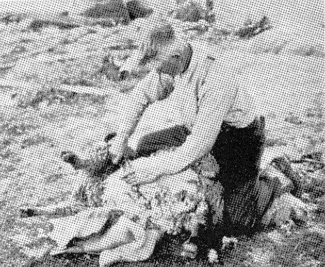
The Boulder Field North of 138 Before Construction
 This rustic view is of a portion of the boulder field north of the high ground over which Rte.138 passed. It also was ground zero for the construction of RI-95’s “Kingston Interchange” that was to become Exit #3 on I-95.
Looking East From The Boulder Field
 This is a view of the boulder field looking east.
Notice
- The low roof-line of a house can be seen in the center of the photo. It is just above the rail that is laying on the stone wall that is nearest the camera. This was the Paine family home and still standing at the same location today!
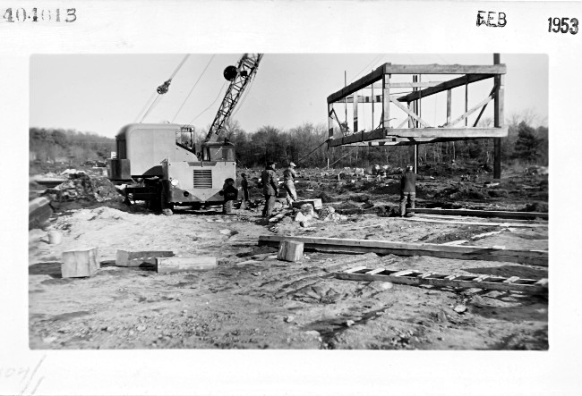
Excavation of The Boulder Field
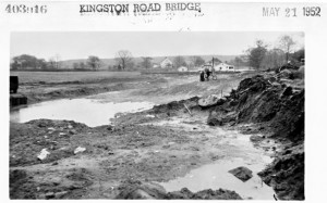
 May 1952: construction of the “Kingston Interchange” is underway.
Looking East From The Excavation
 Notice

- There are three houses visible in this photo.
- #1 is white and behind the group of people and to the right of the nearest pole. It was demolished to build 95’s northbound entry ramp.
- #2 is behind and to the left of the first. It was the Paine House, a 1920’s Arts & Crafts bungalow. Today it is a sign shop at 6 Kingstown Rd.
- #3 is to the left and behind the Paine House. It was the Richmond family farmhouse on Stilson Rd. It was listed as 17 on the SLIDE #2 map, but was lost to commercial development. The McDonalds at 12 Kingstown Rd. is in front of the site where the Richmond house once stood.
The Paine House From The Card Cemetery – 2013
 This recent photo looks at the Paine House across Rte. 138 from John Lewis’s grave marker. Poor John was only 13 when he died in 1806. The Paine House does not appear on the SLIDE #2 map. However, the Card/Lewis Cemetery appears on it as number 14. Exit #3’s Park and Ride, an abandoned section of old 138, is just behind this little cemetery.
Looking North At The Bridge Construction Site
 This May of 1952 photo was taken on the high ground over which Rte. 138 passed. Rte. 138 would be behind the photographer. The gap in the trees in the far background is being blasted and excavated through the ledges to allow the new “Superhighway” to pass.
Looking North At The Bridge Construction Site – Again
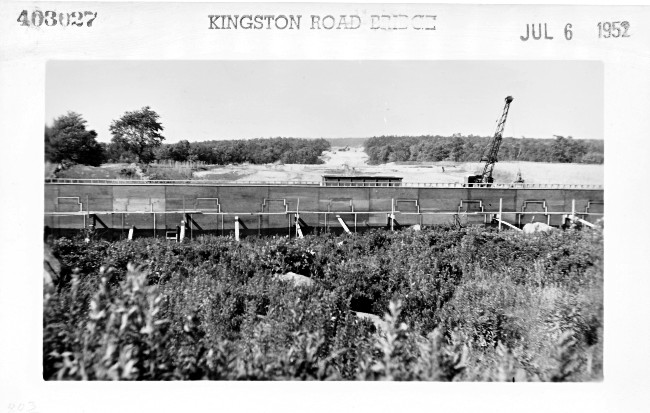 By July of 1952 forms are in place in preparation for cement work.
Notice
- The gap in the ledges beyond is deeper and wider.
- The fields of the Card farm have been stripped of top soil along what will be the route of the new highway.
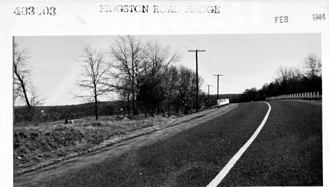
Looking West At Rte. 138’s New Route
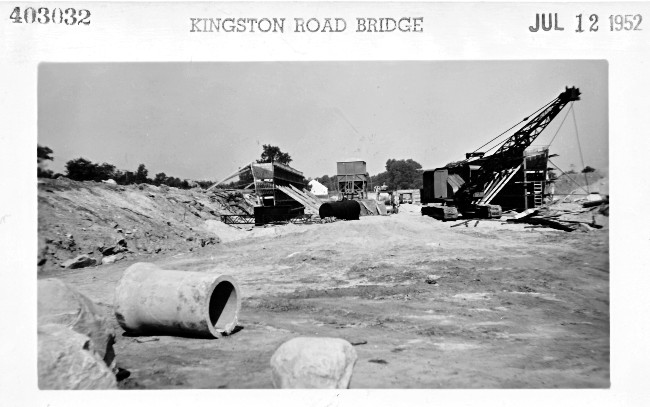 This view shows the excavated area that will allow Rte. 138 to pass under the “Superhighway” once it is complete. The concrete forms are in place for the bridge’s concrete abutments.
Notice
- The high ground that has carried 138 around and above the boulder field for years is located to the left of the left abutment.
- The Card’s saltbox farm house in the background just to the right of the left-hand abutment. It has already been moved away from construction.
Looking West Over Bridge Deck
 The deck of the bridge is now taking shape. The curve of the rebar on the left part of the photo and the solid vertical wall on the right side indicate that the picture was taken near the right abutment of the overpass.
Notice
- The Card saltbox in the background and the man working on the far edge of the bridge’s deck offer some perspective of its distance away.
View West of Construction Progress
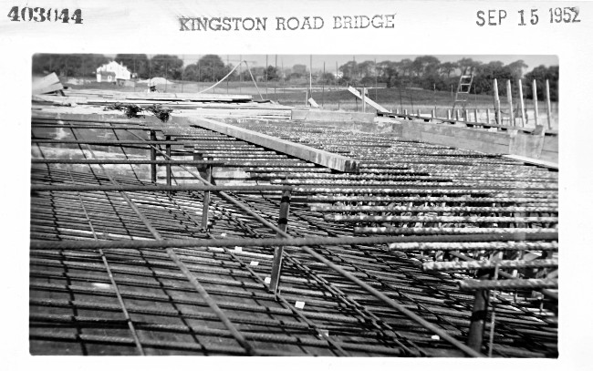
 This photo shows that the over pass is nearing completion in September 1952.
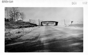
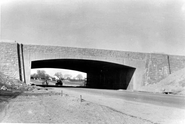
View West At The Finished Structure in December 1952
 Notice
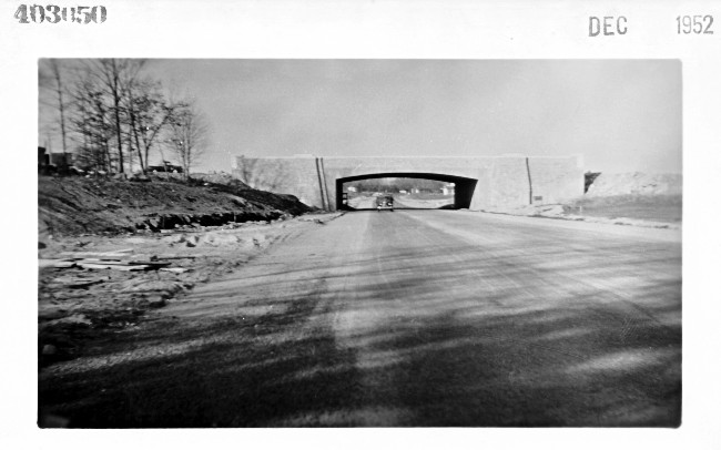
- This bridge will be the centerpiece of the “Kingston Interchange” and was the first major project to be completed along the entire route of I-95. Eventually it will be surrounded by a cloverleaf of ramps and Rhode Island Route 95 will pass over its deck.
- To the left trees still grow on the high ground, while the relocated Rte. 138 passes across what had been the low boulder field.
- A portion of the Card saltbox can be seen behind and to the right of the new bridge. It is clearly some distance to the right of the relocated 138.
View of The left Side of Rte. 138 Beyond The Bridge
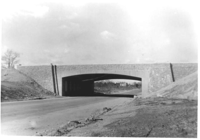 The remodeled District #7 School can be seen in this photo centered under the bridge.
Notice
- If you look for it from under the bridge today, you will not find it. What you will see is the Village Pizza Restaurant, which stands in its place.
The Village Pizza Restaurant in 2013
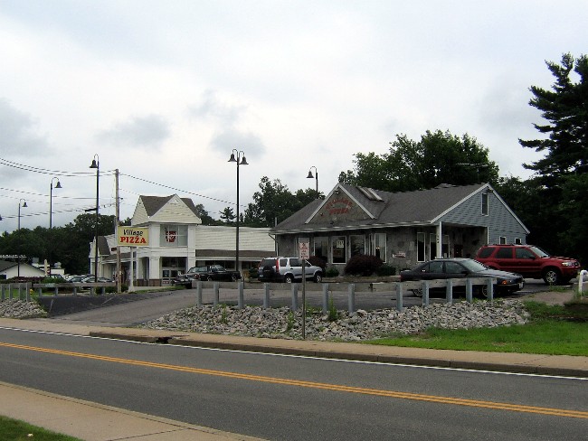 The lot that had once been the school yard for Richmond’s District #7 school children, now hosts pizza patrons and patients looking for prescriptions.
View of The Right Side of Rte. 138 Beyond The Bridge
 From this angle the Card salt box farm house appears centered under the bridge, clearly is not in the way of travel on 138.
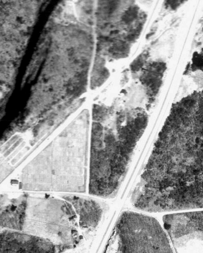
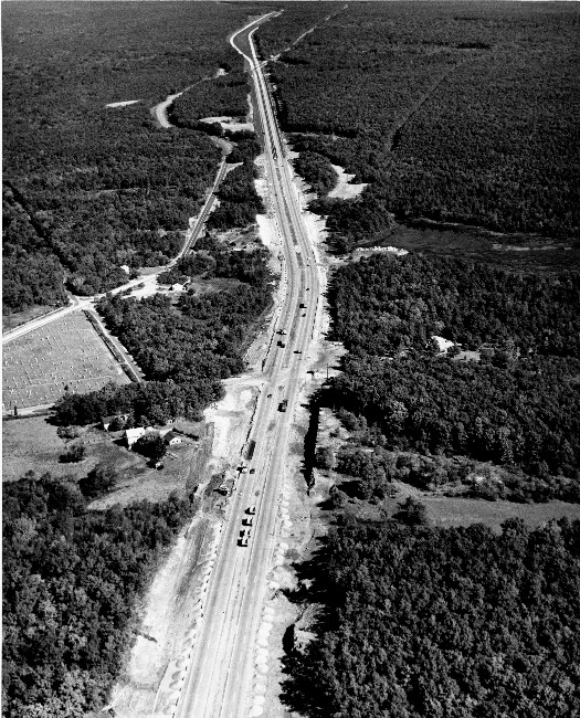
The “Kingston Interchange” Site in May 1953
 This aerial view show the relocated Rte. 138 coming from Wyoming at the bottom and headed toward Kingston at the top.
Notice
- The old 138 road bed curves up to take advantage of the high ground. Also see that an older road bed to its left did the same thing.
- At the top and to the left of 138 is the Arts & Crafts style Paine house. It now is the sign shop at 6 Kingstown Rd.
- At the top and to right there is an abandon piece of the old 138 road bed. This will become Exit #3’s Park & Ride. To the left of that is the
- Card/ Lewis Cemetery, number 14 on the SLIDE #2 map.
- The Card salt box farm house is to the left of 138 where it had been moved before 138 was relocated.
- Near the bottom right of the photo is the remodeled school house. The lot is now occupied by the Village Pizza and Walgreens’ Pharmacy.
- The lot across from the old school is occupied by a private home. Today the Washington Trust Bank has taken its place.
Highway construction and commercial development have changed the face of this area. Little is left here to recall the rural sense of place that it once had. The next series of photos will highlight this transformation.
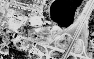
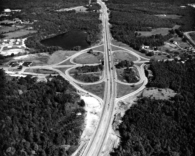
The “Kingston Interchange” in 1962
 This aerial photo shows that little has changed around the Kingston Interchange since RI-95 opened to travel in 1955.
Notice
- There is virtually no development at to the right of the interchange.
- To the left of the interchange and below Rte. 138 there is a new business. The Sun Valley Motel & Restaurant has taken advantage of the frontage on the abandon section of 138 above it. The long narrow building there is the new motel.
- There is large undeveloped property in the upper left-hand corner of the photo. Below it Rte. 138 heads toward Wyoming. This was the estate of Doctor Fredrick Edwards and it will soon see a great deal of development.
The intersection of two major highways is very inviting to development making change here inevitable.
The Dr. Fredrick Edwards Estate
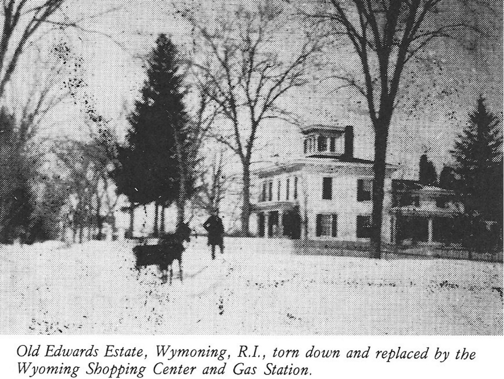 This vintage photo of the Edwards Estate comes from page 249 of the “Driftways” book. The gas station that took its place is listed as number 13 on the SLIDE #2map. The text indicates that this house was typical of homes built by wealthy farmers in the early 1800’s. The text also states that the expansive fields behind the home also were the property of Dr. Edwards. These fields once hosted base ball games that drew hundreds of spectators and the Ringling Brothers Circus when it came to town.
Development Has Begun – In Earnest! in 1972
 Notice

- A gas station now occupies the site of Dr. Edwards’s home.
- The fields that once drew hundreds of baseball fans, as well as wild animals and circus performers also been developed. “Canob Park” and other new homes nearby make up the residential component of development.Notice – The A&P, some small businesses and a large parking lot make up the commercial component of the development.
- Two small private homes still occupy the small lot to the right of A&P’s parking lot.
- A gas station now occupies the site of the Card saltbox.
- On the other side of 138, another gas station occupies part of the school lot, but the remodeled school house still stands on its section of the large school yard.
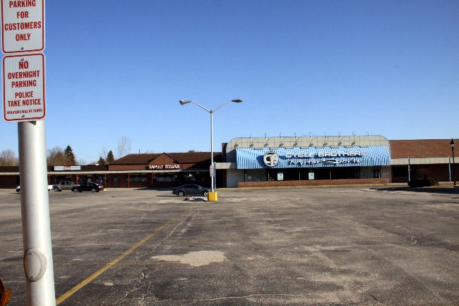
The Commercial Development in 2012
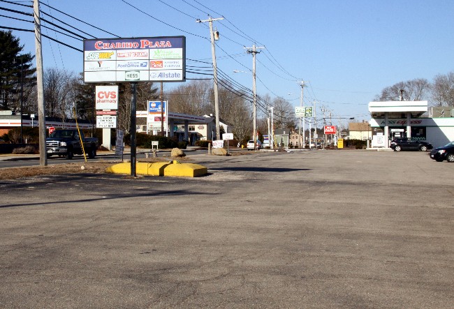 A cacophony of signage clamors for the attention of motorists on Rte. 138. As a whole, they present a different aesthetic and ethos than when Dr. Edwards lived in the house seen in Slide #25. He showed community sprit by inviting base ball teams representing local mills to play ball on his fields and the circus to set up to entertain the village. The current businesses pay local taxes, but often their profits go to corporations far away.
Notice
- The Lehigh Gas station, mentioned as number 13 on the SLIDE #2 map, is now a Hess Gas Station.
The Commercial Development Requires Parking
 The large open fields that once spread out east of the Edwards Estate are now paved for parking. This results in greater runoff of rain water. This in turn carries impurities in to the ground water rather than filtering the water as did the good doctor’s hay fields.
Note – The “Big Box” that once housed the A&P and then the Stop & Shop has been vacant for a number of years. It contributes little to the local economy and nothing to the aesthetics of the area.
Commercial Development Near The Card Farm
 This photo was taken in the mid-1970,s from in front of the Sun Valley Motel & Restaurant. The pine tree had stood near the Card driveway before the house was moved. The Mobil gas station seen through the tree still stands nearly on the site of the moved Card house. The Exxon sign draws attention to a gas station located on next to the motel and restaurant on the south side of 138.
Note – This gas station did not replace the District #7 school, but did share the school lot with the remodeled school house for a time.
As It Is Now in 2012
 Notice
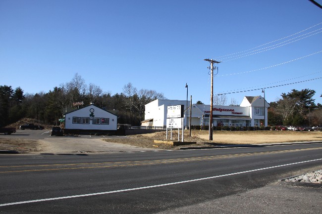
- The old white pine is long gone.
Recently the Sun Valley Motel buildings were demolished. The restaurant building remained and reopened as Ernie T’s. The gas station was also demolished and replaced by the Walgreens Pharmacy, one of three drug stores within a half a mile.
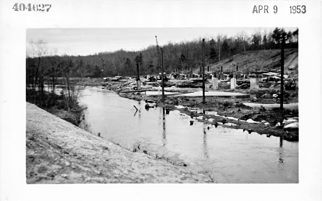
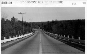
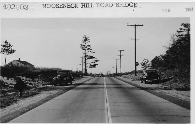
The Gap to be Bridged Over Wood River
 In December 1952 the bridge allowing the relocation of Rte. 138 had recently been completed. However, the bridge that would allow Rte. 95 to pass over Wood River had not even begun.
Hopkinton is on the left side of the photo; Richmond is on the right.
Notice
- The gap to be bridged stretches from to the left of the truck on the old Wood River Branch railroad bed to the large gravel pile on the far right of the photo.
The following series of pictures shows the progress of bridging this gap.
Two Months of Progress
 Frames for coffer dams were set into the water allowing concrete footings to be poured which will support the bridge pilings.
Four Months of Progress
 This photo was taken from the large gravel pile on Richmond side of the river.
Notice
- Several rows of footings are in place along the river’s edge. These will support the piling that in turn will support the new bridge.
- The river curves in this picture. By the time the bridge is completed here the river will be straightened to flow in a straight line underneath the bridge.
Eight Months of Progress: The Gap Narrows
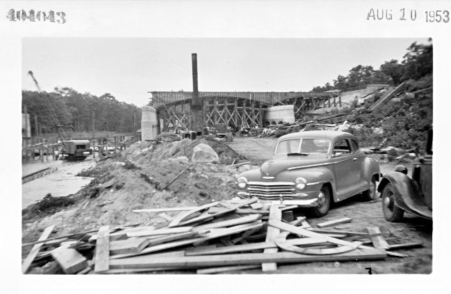 Photo taken from the from the old railroad bed on the Hopkinton side and looking southeast away from Hope Valley.
Notice
- Pilings are on their footings and the bridge’s superstructure has begun, but there is still a gap on the Richmond side.
Thirteen Months and the Gap is Closed
 The bridge over Wood River that connects Richmond & Hopkinton was completed in January 1953. This was thirteen months after the bridge at the “Kingston Interchange” had been built.
This photo was taken from the Richmond side of the river in July of 1953.
Notice
- The river flows straight under the bridge rather than curving toward Richmond as it did before construction began.
Water Under The Bridge in 1966
 This photo was taken in March of 1966 when the river is high. The view is toward Hope Valley along the abandon Wood River Branch Railroad bed.
Between 1968 and 1970 Rhode Island will be updating Rhode Island Rte. 95 to meet federal safety standards. This includes limiting access to the highway by bridging or dead ending all secondary roads that cross RI-95. Once the updates are in place RI-95 will become a part of Federal Interstate System, I-95. Paving and extending and paving this section of the Wood River Branch Railroad bed will be a part of that effort.
RI-95 Passes Over Wood River in 1962
 Wood River flows down from Hope Valley and straight under the bridge toward Woodville and Alton. Richmond is on the right side of the river andHopkinton is on the left.
RI-95 passes diagonally over the river fromRichmond toHopkinton.
Notice
- The long and wide gravel bank on either side of 95 before it crosses fromRichmond intoHopkinton.
- The side of that gravel bank above 95 seems to hold back a curved body of water that appears to be almost connected to the river itself.
- The road that crosses RI-95 directly at the upper center of the photo is Switch Rd. When the highway is upgraded to Interstate -95, Switch Rd. will be dead ended. The abandon railroad bed seen on the Hopkinton side of the river will be extended to meet a new section of Switch Rd. at a smaller new bridge over the river.
Before construction the river curved into Richmond at this point. This body of water is all that remains of the curve. The river was straighten making the gap to be spanned shorter.
The dead ending of Switch Rd. will have an unexpected effect on an historic Richmond property by the Hope Valley Dam.
The series of photo follow deal with the loss off that historic property.
Industry On Wood River c. 1890
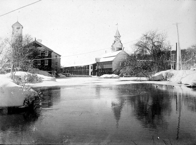 This photo was taken above the Hope Valley Dam that was built across Wood River about 1765. The photo reflects the high point of the industry that grew here as a result of the water power generated by the dam. The Nichols & Langworthy Machine Shop, the factory to the right of the dam, is on the Hopkinton side of the river. The mill at the left of the dam, the Richmondside, was a woolen mill for much of its existence. The initial structure was built of stone in 1810. It appears as the darker portion of the complex that is nearest to the camera. The rest of the building was added over time and made of wood.
The Hope Valley Manufacturing Co. 1857 to 1897
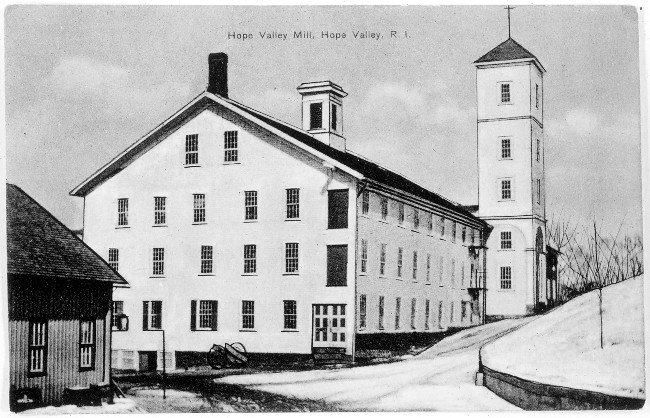 This photo taken in the latter part of the 19th century show the larger, wooden part of the complex. Its gable end is facing Switch Road just over the bridge in Richmond. The tower at its side faces a cluster of modest homes for mill worker. The mill is now gone but the well kept mill houses remain as a reminder of the past.
A View Across the Dam in 1941
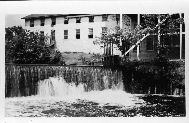 At the time this photo was taken the mill was called The Wood River Woolen Company which operated from 1934 to 1954. Here the old stone structure is to the left and is set back from the wooden structure. A spillway gate is at the end of the dam. This controls the flow of water that provides the mill’s power.
By this time the New England textile industry had been in a decline for many years. The building was sold in 1954 and was turned into a hen house!
A Mr. Luchka bought the old mill building in 1960. He used it as a warehouse for his rag and paper recycling business. Trucks came off RI-95 onto Switch Road for pick-ups and deliveries. However, that route would be cut off when RI-95 was upgraded to Interstate-95.
RI-95 Passes Over Wood River in 1972
 The federal upgrade of RI-95 to I-95 took place between 1968 & 1970. This 1972 aerial photo shows the result of that upgrade in the area of the Wood River Bridge.
Notice
- At the upper center Switch Rd. no longer crosses 95; it has been dead ended.
- The old Wood River Branch Railroad bed has been paved and extended as Mechanic St. It now reaches to a new bridge over Wood River where it meets a newly constructed section of Switch Rd.
This arrangement made travel on 95 and on the secondary road much safer. However, it also made it impossible for Mr. Luchka to carry on his business.
The Old Mill Building in Richmond in 1974
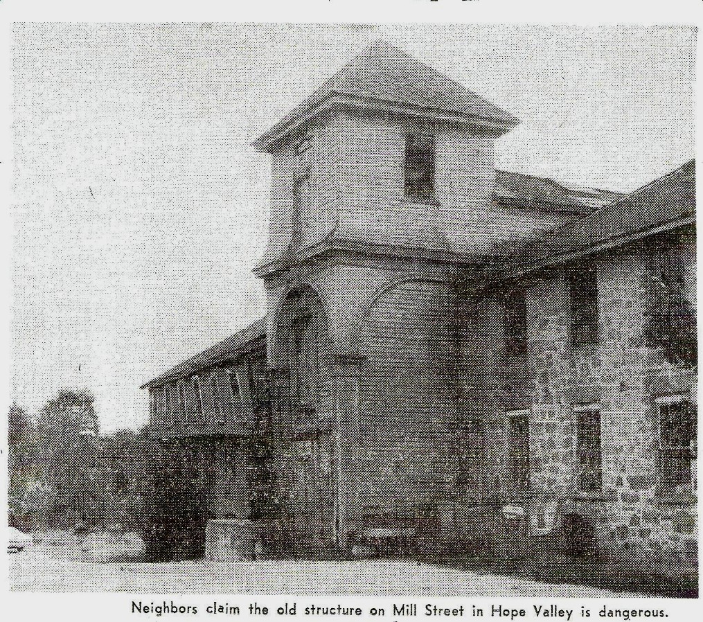 After Switch Road was dead ended, trucks would have had to come to his warehouse over the bridge by the Hope Valley Dam. At the time that bridge was unable to take the weight of the trucks. Mr. Luchka’s business ground to a halt. Already the building had suffered years of neglect. Now it was in peril of collapse and its owner had no income to invest in it.
Notice
- Both the tower and the main building have lost their upper stories.
- The wooden section of the mill is dangerously deteriorated. A group of people pushed to have it demolished.
- The the original stone section, “The Old Stone Mill”, was still salvageable. Other people pushed to spare at least this part of the building and repurpose it. This group felt that its location on the river back would be ideal for a B & B.
A Decision Made by Fate & Fire – 1975
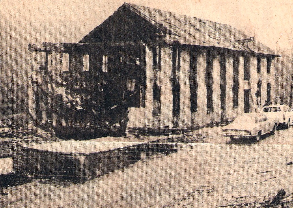 A fire in 1975 completely destroyed the wooden part of the mill. The Old Stone Mill section remained standing but was gutted and unsafe.
The Hope Valley Dam & The Old Stone Mill – 1979
 The stone section of the mill continued to stand for several years, but was considered a safety hazard. Eventually it fell to the wrecking ball.
The Old Stone Mill Site in 2012
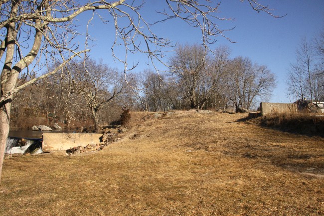 All that’s left of this once productive New England textile mill is the site on which it once stood. A few people may still recall it or may even have worked in this old building.
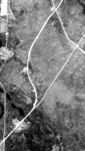
From Rte. 138 to the Wood River Cemetery in 1939
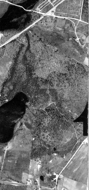 While Rte. 138 was being relocated to pass underneath the bridge at the “Kingston Interchange”, work was also going on to the north. This 1939 photo provides an over of the area where that work will be taking place.
Notice
- The boulder field on the Card Farm and Rte. 138 can be seen at the bottom of the picture.
- Canob Pond at the left; Stilson Rd goes off diagonally to the right.
- Wood River Cemetery is at the top center of the photo.
- The Hannuksella Fram is below and to the right of the cemetery.
Rhode Island -95 will pass diagonally from the boulder field on 138 and pass a little to the right of the cemetery.
The next series of pictures follow construction progress from the “Kingston Interchange” to the area near Baker Pine Road.
Ledges North of “The Kingston Interchange” c. 1953
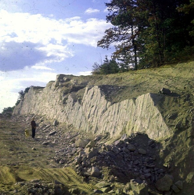 These ledges presented a barrier as construction neared the Hannuksella Farm. Here Earl Smith and his dog check out the progress where blasting has made a gap in the ledges. Exposed rock faces will remain close to both travel lanes of the highway until the 1968/70 upgrades bring RI-95 into compliance with federal standards.
The Ledges Next to the Completed Southbound Lanes
 The rock face near the south travel lanes of RI-95 was not as massive, but perhaps even closer to the highway than the one on the opposite side.
Notice – The RI-3/RI-95 signs tells the traveler that these two state roads are combined at this point.
Note – The 3/95 combination continued for many years from the “Kingston Interchange” to the Exeter border and beyond.
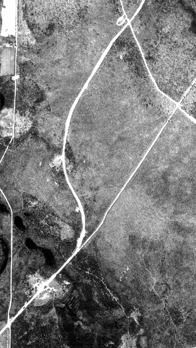
A Closer Look Near the Wood River Cemetery – 1939
 Notice – Rte. 3 goes diagonally up from left to right, dividing the newer part of the of the cemetery near Wood River from the older, triangular section.Notice – Skunk Hill Rd. crosses Rte. 3 by the Wood River Chapel and follows the lower edge of the cemetery to an intersection with Stilson Road.
Note – The Hannuksella Farm is below and slightly to the right of the cemetery. The driveway from it splits to form a “Y” and connects to Skunk Hill Road in 2 places.
Note – The Hannuksella farm will be split by RI-95.
A Preliminary Survey Map of the Hannuksella Farm
 This map indicates that the Hannukesella Farm will be totally destroyed by the road construction. The next slide shows what actually happened.
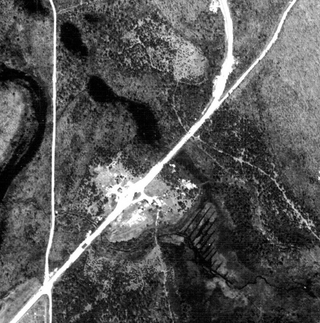
1962 RI-95 Passes by Wood River Cemetery
 When RI-95 opened in 1955, the Hannuksella Farm was not obliterated. The farm house remained in place but some of the out buildings were lost or moved. The cow barn was moved out of 95’s way. However, there were times when the cows had to be herded from one side of the highway to pasture on the other side!
Notice
- Skunk Hill Rd. crosses RI-95 directly.
Cemetery St. Crosses RI-95/RI-3 c. 1966
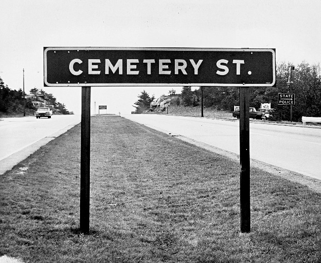 This sign warns traffic on the new highway that it is approaching a dangerous intersection. The secondary road was known as Skunk Hill Rd on old Richmond maps, but is posted here as “Cemetery St.” by the state.
Notice
- The “State Police” sign. The Hope Valley barracks was where it is today, about mile away on old Rte.-3. A police cruiser headed for an emergency may not stop at the stop sign here! The traveler on RI-95 would need to approach this intersection with caution.
- There are 2 other signs behind the parked vehicles. One advertises Kay Dee Country Store on Skunk Hill Road in Hopkinton. The other advertises Valley Lodge Estates, a residential development. The new highway shortened travel-times and made the area a desirable place to live.
Wood River Cemetery to Baker Pines Rd. in 1939
 Notice
- The Triangular tip of the Wood River Cemetery is in the lower left corner of this photo.
- Rte. 3 comes by tip of the cemetery and passes through the clearing beyond it. To this point Rte. 3 has followed the roadbed of old New London Turnpike. The old turnpike continues along that line.
- Rte. 3 leaves the turnpike roadbed to go up Nooseneck Hill in a sweeping “S” curve. By doing so it lessens the effects of the steep hill and avoids large outcroppings of ledge.
- At the top of the photo Rte. 3 crosses Baker Pines Road.
Note – Soon after crossing Baker Pines, Rte. 3 widens into a widens into 4 lane highway and continues onto Exeter, West Greenwich and Coventry.
A Closer Look Above the Wood River Cemetery in 1939
 Notice
- There are several buildings in the clearing at the center of the photo.
- Beyond the clearing is the point at which Rte. 3 leaves the old turnpike roadbed to make the “S” curve up Nooseneck Hill.
- To the right of the clearing there is a strange body of water. Two streams seem to be connected by parallel lines of water. This was Moonshine Cranberry Bog and was actively producing cranberries.
RI-95 will pass over the clearing. The house here be moved about 100 yards closer to the cemetery where it still stands today.
The next 2 slides will show this area near the clearing at ground level, before construction began.
Looking North From the Point RI-95 Will Cross Rte. 3
 Notice

- In the background is the point at which the New London Turnpike goes straight and Rte. 3 starts its “S” curve up to the left.
Looking South From the Point RI-95 Will Cross Rte. 3
 Notice
- Above the road bank at the left is the house seen in the clearing. It will be moved to avoid the construction to come.
Looking Closely at the area in 1962
 Notice

- The new highway passes over the clearing seen in Slides 55 & 56. The house that once stood there is now much closer to the cemetery.
- The new highway cuts across a segment of the of the “S” curve. Therefore, it crosses Rte. 3 twice within a short distance.
- A new section of road, nearly parallel to RI-95, has been built. This is a partial solution to the above problem. This segment of road is part of Rte. 3 today
- One the streams of the cranberry bog has been dammed by RI-95. Now the bog has flooded to become Moonshine Pond, which can be seen from 95 today.
Note – Construction in this area will be complicated by the fact that traffic will still have to move through or around the work being done.
A Wider View of the Area in 1962
 At the top center of this composite photo, RI-95 meshes with the four lane segment of Rte. 3 that existed beyond Pine Hill Road before construction.
Notice
- Part of the “S” curve of the old roadbed and the new segment of road parallel to RI-95 serve to allow traffic to flow during construction.
Still, there were times when Rte. 3’s traffic had detoured around the construction via Rte. 165 and Arcadia Road.
The Upgrade of Rhode Island-95 In Progress in 1968
 Here back at the “Kingston Interchange” work has begun to bring it into compliance with federal interstate highway regulations. When finished, it will be known as Exit #3 on Interstate-95.
Notice
- Notice – The original entrance and exit ramps are abrupt as compared to what we know today. In the left-foreground grading is being done at the southbound entrance so the ramp can merge more gradually. On the right there is an outcropping of ledge that will have to be blasted away to make the northbound exit ramp more gradual an and safer for traffic as well.
- Notice – Similar work has not yet begun at the other end of the cloverleaf.
- Notice – Efforts to upgrade RI – 95 are also taking place north of the interchange.
The next series of photos will focus on that area.
Upgrade Progress North Of Exit #3 in 1968
 The Hannuksella Farm is in the mid-foreground to the left of the highway.
Notice
- The ledges that had been in front the farm and at the edge of RI-95’s southbound lanes have been removed altogether. The ledges on the opposite side of the highway have also been modified to make a greater safety margin for fast moving traffic.
- “Cemetery Street” just beyond the farm is still open to traffic. However, It will be dead ended as part of the upgrade. The section on the northbound side of the highway will become Buttonwood Rd. and will be dead ended after it intersects with Stilson road.
- The top center of the photo shows that a new section of what will become Interstate – 95.
Much of this new section is complete and paved. However, it is not yet complete near Exit #5 in West Greenwich at the other end.
The underpass that will take Rte. 3 safely under 95 has not yet been build. At this time (1968) RI-95/RI-3 traffic is still using the old four lane Rte. 3 roadbed built in the late 1930’s to take traffic north.
Travelers Be Warned – Hazards Ahead!
 Here, RI-95/RI-3 has merged onto the 1930’s roadbed of Rte. 3. The businesses and homes built since the 30’s and before still line the roadside.
Notice
- The sign that greets travelers is a simple and direct warning!
The first business along the way is Knerr’s Filling Station just beyond the sign.
Knerr’s Filling Station Was Just Beyond the Sign
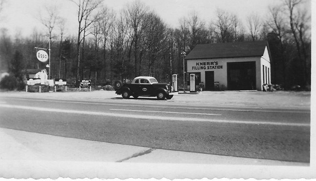 This picture was taken in 1951. Traffic was much denser by the late 1960’s.
RI-95/RI-3 Traffic Approaching Rte. 165 in Exeter
 This photo was taken in 1966. It shows traffic typical of this highway at the time.
The Circle Marks the Spot
 This is where the overpass allowing I-95 to pass safely over Route -3 will be built.
Notice
- The circle on this photo marks the center of the future Baker Pine Road overpass.
- The clearing at the right will become the north bound exit ramp for Exit #4.
- In the far background, behind the VW bus, the highway bears to the right. That is the point at which RI-95/RI-3 turns on to the original 1930’s Rte. 3 roadbed that was seen in the last two slides.
The Baker Pines Road Bridge in 2012
 In Slide #62 taken in October 1968, a segment of I-95 could be seen north of Baker Pine Road. That segment appeared to be completed and paved, but not opened to travel. In fact, that last segment of I- 95 was not officially opened until over a year later, November 22, 1969. The bridge pictured here was necessary to allow I-95 traffic to pass safely over traffic on Rte. 3.
Knerr’s Filling Station in 2012
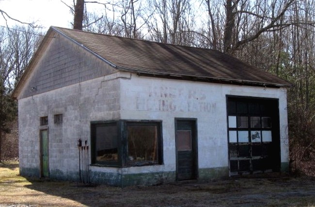 Once the last segment of I-95 opened in October of 1969, traffic on Rte. 3 decreased dramatically. With fewer cars on the road, a number of businesses failed for lack of customers. Knerr’s Filling Station was one of these.
Below are Richard Wolke’s thoughts regarding the overall impact if Interstate -95 on the Town of Richmond.
On the PLUS side:
Interstate-95 made automobile transportation safer and more efficient, allowing people to:
- live in “country” but work much farther away
- have greater access to cultural and social events in nearby cities
- experience increasing development in the local economy
On the MINUS side:
Interstate – 95 brought these less welcome changes to the area:
- the destruction of historic buildings and other historic resources
- the destruction of farms and the rural nature of the area<
- a significant influx of people from more urban and suburban areas, who did not understand the “sense of place” of their new home
- the above issues marked the creation of a “bedroom” community in what had been a rural farming community with scattered small villages

